View Dunbridge to Salisbury in a larger map

We set off from the station in dubious weather. Almost as soon as we take the first footpath (a track) Louise spots a dead mayfly on the ground - a memento from the amazing mayfly hatch I witnessed last week.


After passing through a meadow we cross back over the railway line and the footpath meanders through some fields, narrowing before crossing over the River Dun, another clear trout stream.

This brings us into the village of Butts Green. There is, in fact a triangular village green.

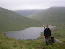
As we leave the village we spot a house called Netherfield and I take a photo of Louise as we are both Jane Austen fans.

There is a bit of confusion with footpaths as we go from Butts Green to Lockerly, not helped by an uprooted sign post.
But we pick up a hedged footpath that is clear enough.

And from this we get on a footpath that leads up to the top of a chalk escarpment that should lead us west towards Salisbury.

To start with the footpath is clear enough and, once we have got to the top, it is is very pleasant walking, with views opening up to the north when the clouds and on and off drizzle allow.
And we spot a yellowhammer which flits from post to post in front of us for a while.

But soon the path becomes very unclear. This is a surprise to me. It is true that this is just a footpath but it leads along a clear ridge top in beautiful country and I expected it to be better used. There are no other walkers to be seen and, as we continue, the path is only really discernible because there is a line of trees on one side of a field.

We reach a corner and it gets more puzzling still. The tree edge dog legs right but, according to the map, the footpath cuts across a field of green wheat. And in fact there is a faint line discernable in the right general direction. After puzzling at the map a bit we head off across the field. Louise, a little reluctantly at first, as walking through farmer's crops in Australia is to risk having wombats set on you.
And she has a point. The corn is wet and walking through it is soaking any lower parts of our trousers that have remained dryish (which is not many).
Eventually we forsake the possible path for a bigger tractor track that is not to far from the right direction, following it to the edge of the field near to Deanhill Barn.

We pick up a good track here, which is a relief, but not for very long, because it leads to something entirely unexpected. There is a pill box and beyond it a big security fence - with signs threatening deportation to Guantanamo Bay or something if you trespass. I look at the map. There is nothing special marked - though sometimes MOD instillations like to keep a low profile. Still this fence is so big that I would have expected to see something.

But there is no real doubt that we are where I think, as the barn and other landmarks are clear enough. So we set off through more drizzle.
This is a little disappointing. I picked this route because, though there are trees marked to the north, they are on the escarpment and I had hoped for great views from over them. In fact we get a great view of the huge security fence and some trees. There is also a line of old pillboxes, none of which are marked.

Later,we discover that we are in fact on top of an old and enormous ammunition bunker. This chalk down has been hollowed out and until 2004 was used to store ammunition for the armed forces. I guess the bunkers were to defend it during the Second World War http://www.deanhillpark.co.uk/history-office-complex.php
After a kilometer or so our footpath is joined by a bridle path, and the going is good until we cross a small road. Here the drizzle decides to get serious
 and, as there is a big sheltering tree, we stop for coffee and a bite to eat.

Over the road the way becomes a byeway for a bit. There are some fine houses with spectacular gardens to the side. Unfortunately we come across a truly spectacular dog idiot - whose large dog snarls at us. They haul it away but say not a word to us, not even acknowledging our existence.
 We emerge from overhanging trees onto a track, passing a spacey water tower. The fence forsook us at the road and we do get good views now, over rolling, well wooded countryside to the north.
In fact I am a bit sad to leave the ridge, especially as our way leads down to a road and mostly road walking into Salisbury. There is an alternative, to continue on to Pepperbox Hill. But it is not clear how we would get to Salisbury from there other than via the A34 which looks potentially hellacious. It is also further that way.

So we take a side track that winds delightfully down the escarpment.

Sadly, the road we pick up at the bottom is considerably less delightful. It is only moderately busy but it is very fast and there is no footpath and mostly no verge either. We put our heads down and hurry into West Grimstead, glad to find a footpath.

West Grimstead has some fine thatched cottages but we do not linger. The showers are going by with dismal regularity. And though we have made good time there is a fair way to go. We take a slip road to the A34 before a bridge over it and here we spot some orchids. It is an unlovely spot but the flowers here, not just orchids but campion and wild geraniums, give it a little touch of magic.


And at least there is a footpath. This might not be delightful walking but we are not in any fear of being run over now.
A smaller road takes us downhill to the left. There are woods to the side and in these there is a pit dug in the sand. It looks odd but when we investigate it seems to have been the source of sand for building bmx jumps.
No riders though. Guess it is too soggy a day for them.
At the bottom of the road is a little hamlet called Shute End. Here there is a footpath marked going across the river Avon and into Salisbury, enabling us to avoid the main road. However there is absolutely no sign of it at all.

We walk up the road. We walk back. We puzzle at the entrance to a house that seems to be in the right place. We try the woods beyond the house. There is an old gate and we squeeze through and wander about. We can see marshes just below the woods but it is a steep descent. Eventually we scramble down but there is no sign of a path or of a bridge and so, reluctantly, we scramble back up again.

I poke my head into the house entrance but there is no sign of a path or a bridge, just someone's garden.
 There is another footpath marked further south. I had discussed this with Louise earlier on, saying that my instincts told me that it could be very marshy. And there was no footbridge or stepping stones marked (in fact there was not for this path either but I missed that). Time is pressing now so we march down the road and find the little side road that leads to some farm buildings. It stops. No footpath sign. Louise suggests we climb over the gate and try to make our way through the fields to the first path but I am not convinced that we are going to find a way over the river.
So very reluctantly we trudge back to Shute End. When we get there a guy is working on his car and so I ask him if he knows where the footpath is. He says there is none now and no way over the river, other than the road we are taking, unless we go miles to the south.
 This is something I have never come across before and I am a bit embarrased by it. True I should have spotted that no bridge was marked but for two rights of way to be clearly marked on a brand new 25,000 OS map when nothing at all exists on the ground is something new in my experience.
Around Selbourne I had to scramble under barbed wire but at least I knew where the footpath was. And on the way in to Alresford I was misled by a track that turned into a stream, but that was mainly my fault for not spotting that the footpath went a different way. But two routes, alternate ways across the river valley half a mile or so apart, both completely defunct. That is a new one to me.
But we have trains and buses to catch so there is nothing to do but trudge along the road.

And in fact when we come to the main road there is a footpath so it is not so bad.

And after a short busy stretch, less than a kilometer, we are able to forsake it at Petersfinger, taking a much smaller road, which briefly dips back into countryside. There is even a footpath through a field for a brief spell.

And then we are trudging into to Salisbury. Louise has been here before and has got a streetmap. She works out where the coach station is and then kindly accompanies me to the train station. This is quite a way off on the other side of town, so she is doing very well considering that she said she only wanted to walk ten miles or so and we have done around 14 at least by my reckoning.

Having established that I have time for a coffee before catching a train that will take me to my connection in Southampton we are faced with a tiny coffee bar with nowhere to sit. So we set off back to look for somewhere decent. However, this is clearly not the coffee culture end of Salisbury. In fact it is more the dirty bookshop and tattoo parlour district. Deciding against a couple of not very salubrious looking pubs we walk back a way before Louise spots an archway with a sign for a gallery and cafe called Fisherton Mill.http://fishertonmill.co.uk/the-cafe/
 And this turns out to be just what we were after. A very pleasant end to a mixed day with some great walking, if dodgy weather, mixed with some less pleasant roads and some very frustrating disappearing footpaths.
Most of all, it was really great to catch up with Louise and have some company again.

Subscribe to:
Posts (Atom)